In the context of a panel I put together on “Turning Ploughshares into Swords: Weapons and Weaponizations”, the ISA’s annual conference was the occasion for me to present some of the research I have undertaken as part of my long term project into the logistics of military perception. The central aim of that project is to uncover the genealogy and operation of the functional constituents of contemporary targeting practices as they increasingly span the globe. I submit that we can outline three distinct, if profoundly intertwined, functions of sensing, imaging and mapping that respectively gather sensorial information, visually represent and disseminate it, and relate it to geospatial frameworks. It is the last of these operations that was the focus of my paper, with particular attention paid to the way in which the planet has increasingly been enframed within systems of geographic coordinates permitting the geolocation and thereby targeting of any entity caught within their mesh.
While the role of cartography in European colonial expansion from the fifteenth century on is well-known, my main interest here lies in the even more intimate relationship between the histories of weapons targeting and techniques of geospatialisation. From the outset, the development of artillery in the early modern era was closely bound up with that of surveying techniques for the measurement of distances by visual means. Indeed, the range-finding exercises of gunners relied on the same trigonometric methods that underpinned the rise of modern cartography.

Leonhard Zubler, Novum Instrumentum Geometricum (1607)
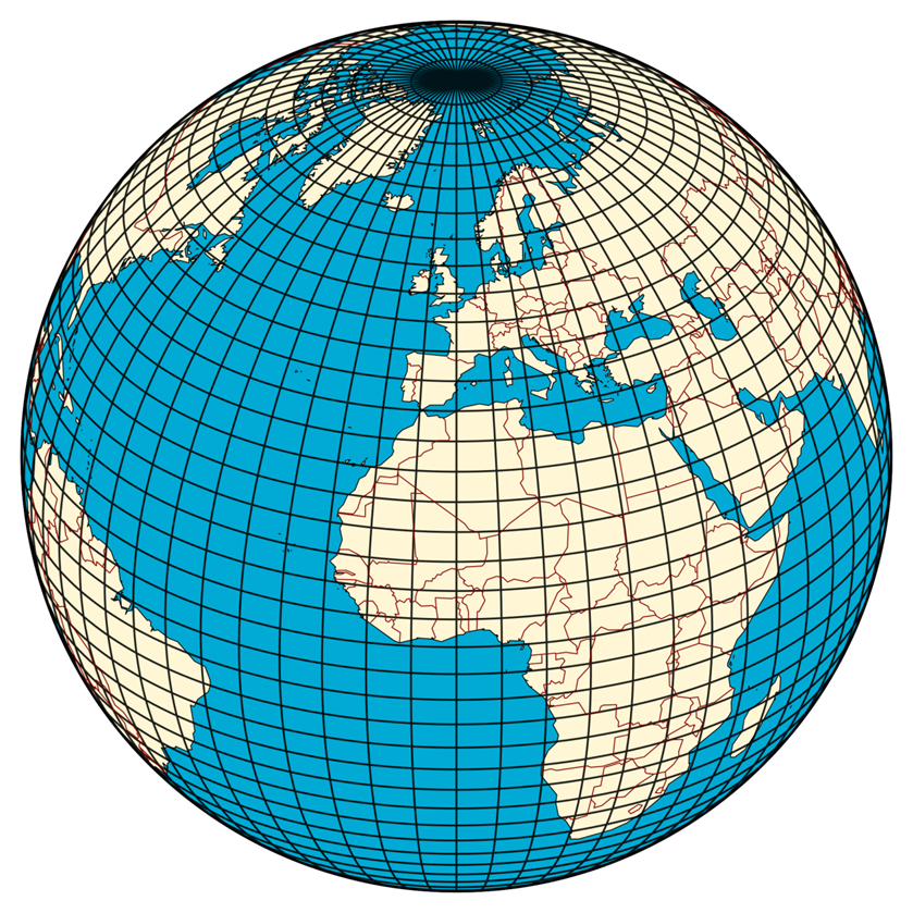
A central feature of this cartographic impulse has been the progressive striation of the globe framed within a Cartesian grid (or graticule) of longitudinal and latitudinal coordinates such that any point upon it can be located and related to all others. As David Harvey tells us:
Cartography is about locating, identifying and bounding phenomena and thereby situating events, processes and things within a coherent spatial frame. It imposes spatial order on phenomena. In its contemporary manifestation, it depends heavily on a Cartesian logic in which res extensa are presumed to be quite separate from the realms of mind and thought and capable of full depiction within some set of coordinates (a grid or graticule).[1]
Critical geographers have long underlined the various aesthetic or ideological considerations that influence the process of map design, thereby problematising the notion that maps are neutral representations of ‘reality’ commonly held to by proponents of scientific mapping. While such pointed critiques are salutary, they however risk thereby occluding the fact that the choice of cartographic projections, scale and features represented within a cartographic representation are also pragmatically oriented by the specific practices of geospatialisation they participate in. So, for example, the Mercator projection we are so familiar with and which was famously attacked by Arno Peters for distorting area sizes to the detriment of the Third World was in the first instance conceived for purposes of navigation by allowing courses of constant bearing to be drawn on the surface of the map as straight lines.[2] The map can therefore also be conceived as a technology for the support and automation of cognitive processes in the manner of the various other ‘material anchors’ for conceptual representation or symbolic manipulation referred to by Edwin Hutchins.[3] Maps accordingly cannot be entirely reduced to their ideological functions, important as they may be in certain instances, but neither are they straightforward representations of reality. Rather, in many cases, they have to be related back to the specific operational assemblages in which they occupy particular cognitive functions and to which contingent but internally consistent criteria of efficacy will apply.
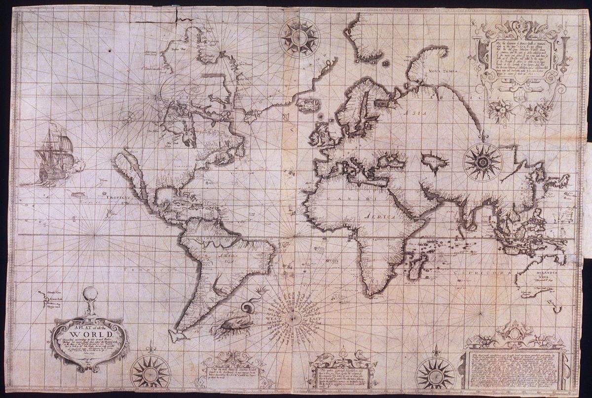
Wright-Molyneux world map (1599)
If maps played an important role in the expanding governance of early modern states, until the late nineteenth century their military function was essentially restricted to assisting in the strategic movement and operational battlefield deployment of troops with virtually no tactical uses made of them outside of siege warfare. Up to that point, the spatial extent of an active battlefield had typically remained restricted enough to permit military commanders to embrace its totality with their own eyes. Hence the French expression of the coup d’oeil employed by both Frederick the Great and Clausewitz to refer to the innate ability of the skilled general to survey the terrain or military situation at a glance and consequently determine the optimal tactics to be employed. Manoeuvres could be instructed by commanding officers to their subordinates by pointing at visible terrain features and artillery guns were aimed at targets that lay in their sights. Maps could therefore be highly valued for guiding the movement of troops throughout a campaign or identifying a location in which to do battle but generally deemed devoid of any tactical value once combat was initiated.
It is thus with the First World War that military cartography truly came of age. For one, the dramatic geographic extension of the field of combat operations would render references to detailed maps essential to the determination and execution of command decisions. Of equal significance, however, was the primary role of artillery during the conflict with the range and accuracy of guns now permitting the targeting of distant positions that could not be directly observed from the weapon system’s location. This technique of indirect fire grew increasingly sophisticated as the war progressed, eventually generalising practices of ‘map shooting’ according to which instructions for the laying of artillery fire are derived from the known geospatial coordinates of a target.
The surveying and cartographic efforts expended by the belligerent were quite simply unprecedented. Britain reportedly printed 34 million war maps, France over 30 million, and Germany a staggering 775 million. Regularly updated maps of the combat areas were produced, integrated under a common meridian, and generated at a variety of scales from 1:100,000 to 1:2,000 to satisfy the various operational uses they were put to. Perhaps the most significant innovation was the introduction of systematic gridding allowing the unique geospatial coordinates of any point to be easily read off any given map. Peter Chasseaud speaks of the emergence of a new “battlefield geometry” through which:
a new geographical information system had been created, providing a sophisticated three-dimensional fire-control database or matrix of the battlefield […] In effect, the battlefield had been digitised; every point could be rendered in metric or yard rectangular co-ordinates.[4]
It is this very process of metricisation of the battlespace that eventually would come to encompass the entire planet under the impulse of preparation for global nuclear war.

The gridding of the battlefield for the purposes of fire control and navigation did develop further with the Second World War, benefiting from a range of innovations in topographic and aerial photogrammetry during the inter-war period. However, armies remained heavily reliant throughout on national maps with their respective grid systems and geodetic reference points which presented complications for the operation of weapon systems spanning several such geographical areas. It is therefore only with the Cold War and the prospect of a truly global confrontation between nuclear powers that a comprehensive and uniform geodetic system enmeshing the entire planet would be erected.
Concerned with planning for a potential confrontation with the Soviet Union in which long-range bombers and missiles would be involved, the United States launched into an intense geodetic and cartographic effort in the immediate aftermath of WWII. In 1947, the US Army adopted the Universal Transverse Mercator (UTM) system alongside the Military Grid Reference System (MGRS) in order to allow for the designation of unique rectangular grid coordinates for any positions on the globe, all the way from 100,000 metre grid squares to 1 metre grid squares.

Universal Transverse Mercator coordinate system
The creation of such a universal reference system was however only one part of the problem, and not the most arduous one at that, since it is necessary to precisely layer such a grid over the geographical surface being mapped, namely here the planetary body of Earth. The accuracy of such an effort relies on the available knowledge of the exact shape of the Earth and the determination of the precise position of geographical points upon it, the establishment of which are the object of the science of geodesy. Since the true shape of the Earth is not that of a perfect sphere but rather one flattened at the poles with a bulge around the equator, geographers have since the late eighteenth century made use of reference ellipsoids that approximate this shape for geospatial measurements and representations. Combined with a set of reference points, a reference ellipsoid is employed to generate the geodetic datum that will support a given geographic coordinate system. Due to the irregularity in the shape of the Earth, different reference ellipsoids may yield more accurate geodetic systems in localised areas but for the purpose of navigation and coherent positioning over greater distances some of this accuracy can be foregone in favour of a global datum. The task of determining the true shape of the earth is further complicated by irregularities in the planet’s gravitational field, necessitating the mathematical formulation of a highly uneven geoid.
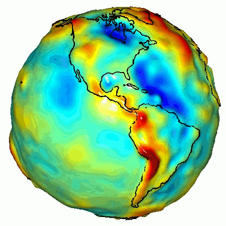
Geoid displaying gravitational anomalies
The imperatives of the Cold War would see, in John Cloud’s words, a “general mobilisation of the earth sciences” that would markedly advance the geodesic description of the globe and with it the military’s geopositioning capabilities.[5] Thus, in 1964, the commander of the Army Map Service would describe the work of his agency as being “primarily concerned with the various existing local datums and in reducing their number until all map information and geodetic data can be referred to a single unified world datum” at which point “the ultimate in a world system will have been reached.”[6] The first attempt at such a global geodetic system by the Department of Defense came in 1960 with the World Geodetic System 1960 (WGS 60). Although WGS 60 constituted proof of concept, its various flaws required subsequent overhauls in the form of WGS 66, WGS 72, and WGS 84, an updated version of the latter being that which remains in current use and onto which the Military Grid Reference System is today overlaid.
Intertwined with these geodetic advances was the development of space-based satellite navigation systems, the most famous and ubiquitous of which is of course the NAVSTAR Global Positioning System (mostly commonly referred to as GPS). In many ways the culmination of all the aforementioned processes of striation, GPS (and other similar systems such as Galileo or GLONASS) permits the geolocation of any point on the globe to a high level of accuracy (up to a 1 metre or less, depending on the receivers and techniques employed) where there is a direct line of sight contact with three or more orbiting satellites. For military purposes, the acquired positional information can be reported in an MGRS format or some such derivation of it.
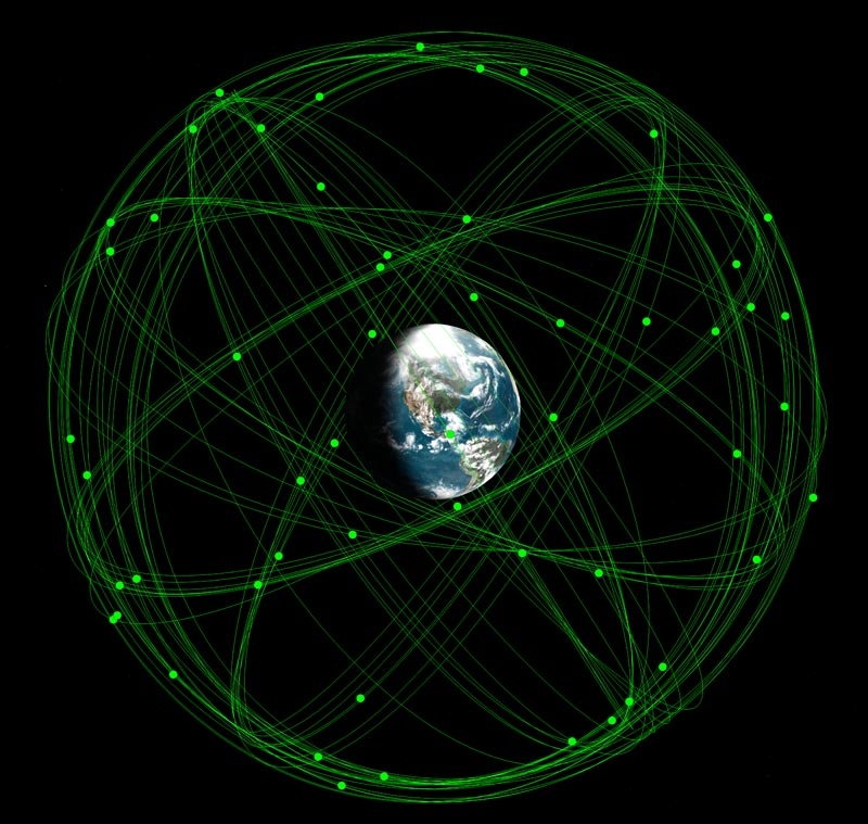
GPS satellite orbits
First employed in a large-scale conflict during the 1991 Gulf War, GPS is today considered a mission-critical component of military operations and vital enabler of the present American vision of high-precision and low-risk warfare. As a task force of the Defense Science Board underlined in its 2005 report on “The Future of the Global Positioning System”:
For military missions, GPS provides an unparalleled force-enhancement tool. GPS aids in all aspects of military combat operations because of its common-datum, common-grid, common-time capabilities. GPS is unique in its ability to establish an unambiguous correlation in four dimensions between a target and a dynamic weapon system aimed at that target – all the time, anywhere on the earth, and under any conditions of light, weather, or other source of target obscuration. This translates directly into increased probability of kill for any particular weapon, increased force employment efficiency for military mission planners, and overall lower risk for the individual military members and units that must execute the missions. To the extent that a target point is defined and a weapon is guided by precise GPS signals, the probability that the target will be hit despite any other circumstances that exist is significantly higher with GPS than with any other combination of targeting and positioning technologies.[7]
The present reach of military targeting enabled by the geolocational enframing of the planet realised in the second half of the last century is perhaps best illustrated by the present American efforts to develop Prompt Global Strike, a system for the delivery of conventional precision weapons anywhere in the world within a single hour. While a range of options are being considered for the delivery of lethal force, from hypersonic delivery vehicles to spaced-based kinetic weapons, none of them would be conceivable without the existing infrastructure of global geopositioning. Brought under the ambit of spatial striation and continuous geographic calculation, ours is a planet thus ever more rendered onto targeting. The history of this present moment also underlines that it is less the case the geography has been belatedly weaponised than there has always been an intimate connection between the cartographic capture and rationalisation of space and the impulse of military targeting.

Artist’s impression of a hypersonic ballistic missile
[1] David Harvey, Spaces of Capital: Towards a Critical Geography (New York: Routledge, 2001), p.220
[2] Of course, the projection of a three-dimensional sphere onto a two-dimensional surface necessarily entails some distortion and the Gall-Peters map proposed to replace the Mercator map is no exception.
[3] Edwin Hutchins, ‘Material Anchors for Conceptual Blends’ Journal of Pragmatics Vol.37, No.10 (2005)
[4] Peter Chasseaud, ‘British, French, German Mapping and Survey on the Western Front in the First World War’ in Peter Doyle, Matthew R. Bennett (eds.) Fields of Battle: Terrain in Military History (Dordrecht: Kluwer Academic Publishers, 2002), p.172
[5] John Cloud, ‘Imaging the World in a Barrel: CORONA and the Clandestine Convergence of the Earth Sciences’ Social Studies of Science Vol.31 No. 1 (2001), p.244
[6] Deborah Jean Warner, ‘Political Geodesy: the Army, the Air Force, and the World Geodetic System of 1960’ Annals of Science 59 (2002), p.374
[7] Defense Science Board Task Force on The Future of the Global Positioning System (Office of the Under Secretary of Defense For Acquisition, Technology, and Logistics, October 2005), p.33

Reblogged this on İSKEMLE.
LikeLike
I’d recommend to you the work of Derek Gregory – not referenced here, but you may already be familiar with him – a geographer at UBC working on targetting and the militarisation of vision. He has a great site at geographicalimaginations.com
LikeLike
Thanks, I indeed follow closely his blog, always very stimulating and relevant to me.
LikeLike
Reblogged this on nyawn.
LikeLike
Reblogged this on marketh.
LikeLike
Pingback: Antoine Bousquet and Weaponized Geography | Society for Radical Geography, Spatial Theory, and Everyday Life
Interesting piece. I quite enjoyed it. I think I’d offer one quibble, though. When you say that “there has always been an intimate connection between the cartographic capture and rationalisation of space and the impulse of military targeting,” I’m not sure “targeting” is quite the right word. Though I haven’t specifically researched it, “targeting” to me is redolent of the aircraft and missile era, whereas you persuasively describe a phenomenon that goes much farther back in time than that.
Even today, use of the word “targeting” (to my ears, at least) marks certain military sub-communities and not others.
LikeLike
Yes, you are right that the terminology of targeting is a more contemporary one. However my generic use of the term is intended to highlight the continuities in the logistical regimentation of perception and spatialisation that run from the early days of gunnery all the way to present-day missile guidance, the analytical purchase of which I hope outweighs any resulting terminological anachronisms.
LikeLike
Reblogged this on Progressive Geographies and commented:
Antoine Bousquet on geography, weapons and global calculation.
LikeLike
Thank you very much. I “piggy backed” this on my FB page under a “postcard” stating that if you need violence to enforce your ideas, your ideas are worthless. Am deeply, deeply saddened by the amount of resources spent on our military industrial complex. It is hard to believe that it is all about defense. So much effort spent on watching, when we should really be participating. Meaningfully.For the sake of peace.
Came across your site, somehow through gleaning items for my personal health/medical news blog. Am finding your posts very insightful. Thank you, you are part of my continuing education efforts!
LikeLike
Reblogged this on Ciencia con Arte – Ccª.
LikeLike
People like Chamayou write about cynegetic war and little ‘halos of hostility’ and targeting individuals borne from topological signatures v. topographic containers; this piece – esp. wrt Prompt Global Strike capacities – connects to new concepts like persistent close air-support, too…ubiquitous + contingent air assets…overlaying these targeting-signals-mapping operations with ‘identity-dominance’/biometrics and HUMINT/human terrain = an empire of signs and an impossible integration machine worthy of Borges’ description of imperial cartography…dialectic of military sense-representation-enlightenment (Farocki…Aufklarung…etc.).
LikeLike
Pingback: The Eye of War: A Symposium | The Disorder Of Things